|
Hurricane Ivan - Forecasts - News - Links
|
News HaitiAction.net |
||||
see also
The Hurricane Ivan page for yesterday,
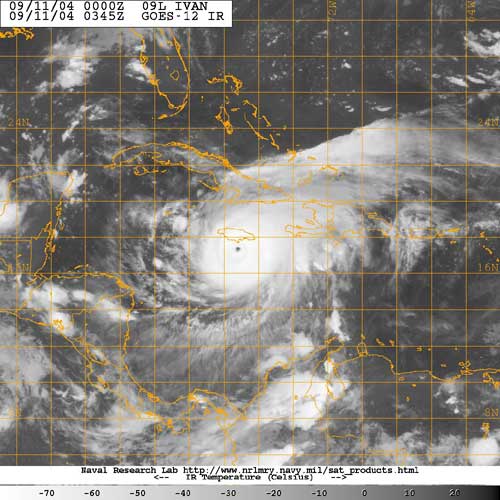
Sept 10 2004
HaitiAction.net page for
 Tropical Cylones
Satellite Images - Forecasts - News - Links
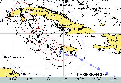
The projected path - black icons above from the USN forecast of 0600 - shows that IVAN is headed for Havana. However - if you read the John Maxwell column for 9/11 - Ivan's voracious appetite for power, the resistance of Cuba and the high pressure zone building in Florida, could just send this extemely dangerous storm closer, on a path, to Crawford, Texas.
FORECASTER RAW - SEPTEMBER 11, 2004
Links for Latest Info on IVAN
- U.S. Navy Tropical Cyclone Page - Monterey Marine Meteorology Division
- National Hurricane Center / Tropical Prediction Center
- Latest ALERT bulletin: Hurricane IVAN update
NWS TPC/NATIONAL HURRICANE CENTER MIAMI FL - Storm Track Maps - University of Wisconson - Tropical Cyclone Research Team - color enhanced java movie will take a few minutes to load on a good broadband connection
- Jamaica Observer -
- AccuWeather.com - Latest on Ivan
Atlantic Satellite Overview - Jamaica Information Service - official releases

this morning - Haiti Time
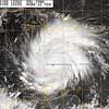
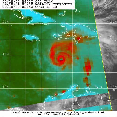
From: NRL Monterey Marine Meteorology Division (Code 7500) Tropical Cyclone Page - 09L.IVAN, VIS1KM, 09 SEP 2004 1500Z -