|
Tropical Storm Ingrid forming in Atlantic could threaten Haiti next week
September 12, 2007 |
News
HaitiAction.net |
||||
 Tropical Storm Ingrid forming in Atlantic could threaten Haiti next week
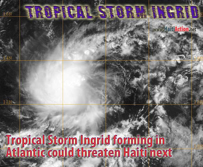
 HaitiAction.net - Port au Prince, Haiti - Tropical Depression 08L approaching the Lesser Antilles is expected to reach tropical storm strength soon becoming Tropical Storm Ingrid, the ninth named storm of the 2007 Hurricane Season . Currently with a WNW heading of 295º the slow moving tropical cyclone is expected to meet with a weakening mid-level ridge which could provide the storm with a more westerly tack. The first computer generated tracking models predict that the initial motion will continue for the next couple of days.
HaitiAction.net will follow the progress of this storm over the next week. The National Hurricane Center posted its first advisory this morning and the depression should pass just south of NDBC weather data buoy Station 41041 in the Mid-Atlantic where the atmospheric temperature is a very warm 81.0º F which will provide conditions favorable to tropical cyclone formation. The next NHC advisory update is scheduled for 5PM AST today.
A tropical wave is moving over Haiti today causing heavy rain in some regions and saturating the ground ahead of possible hurricane conditions next week. Nine Haitians were killed during Hurricane Dean - August 17- which passed 150 miles south of Port au Prince and dumped heavy rains over most of the island.
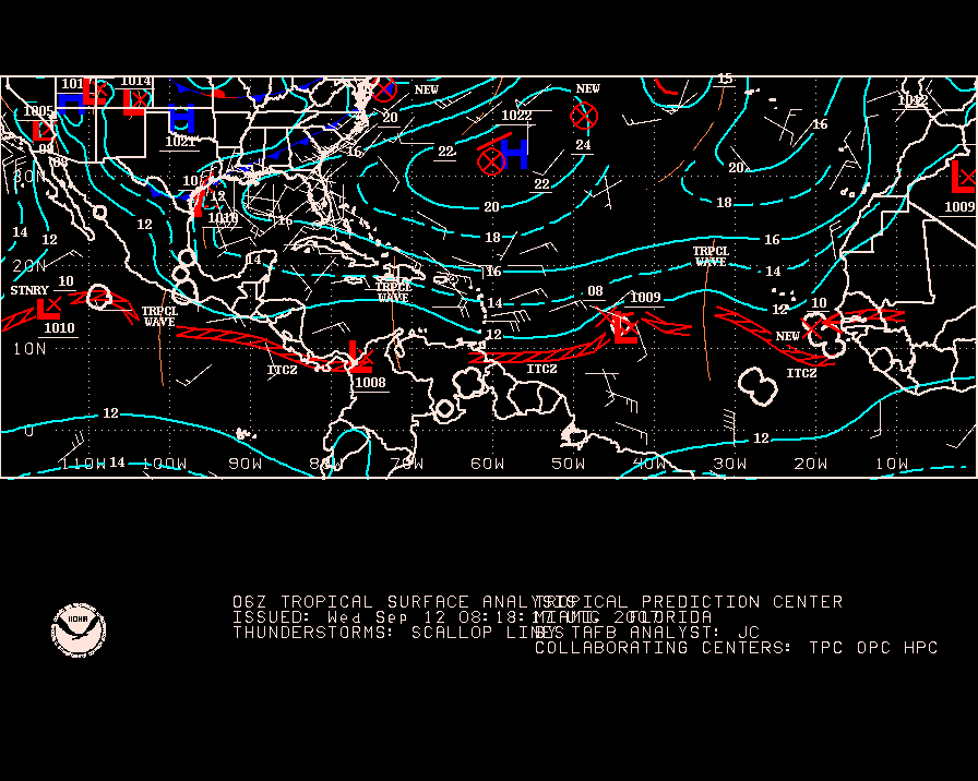
Tropical Storm Humberto approaching the Texas coast in the Gulf of Mexico caused officials to issue a Tropical Storm Warning for the region. It is likely that the storm will weaken as it moves over land soon, if it reached tropical storm strength - 39+ mph - before the system in the Atlantic (08L) \ it will captured the "Humberto" name first, leaving the name "Ingrid" for the other storm.
RAW