Storm Chris Page
October 19, 2005
Regional Storms at  HaitiAction.net 
About Events Talk News Links Home
Please give to: Vanguard Public  Foundation's
Haiti  Emergency  Relief Fund
click for larger image
Storm Chris
on HaitiAction.net

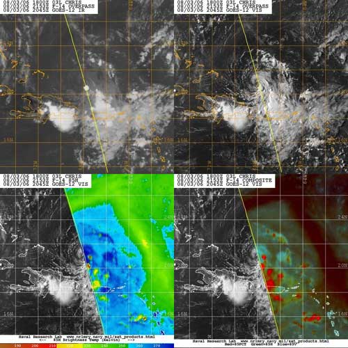
Aug 3 2006 - What's left of the heavy rains — red regions — will move into the Dominican Republic today. Rains have caused som floodin on Puerto Rico after dumping up to 5in of precipitation.
Click image for story
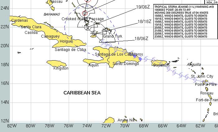
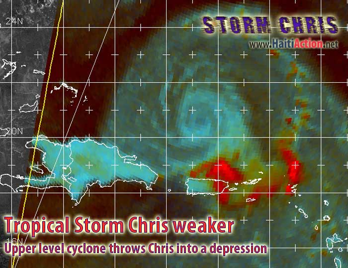
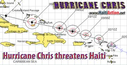
The track of Tropical Storm Jeanne in 2004 looks very similar to that of CHRIS today (above)
Excerpts from the National Hurricane Center advisories:


HaitiAction.net Links Latest Info on Tropical Cyclones for Caribbean
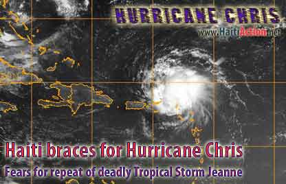
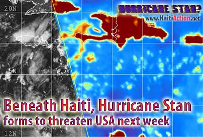
  1. Caribbean/Gulf Satellite movie
    takes a couple minutes to download on DSL
  2. NRL Tropical Cyclone Page
    Monterey Marine Meteorology Division
  3. National Hurricane Center
    Tropical Prediction Center Text only version Latest ALERT bulletins
  4. NOAA Storm Chris Tracker
    Compiles many resources on one window
  5. AccuWeather.com - Latest
    Atlantic Satellite Overview Best map to see what's coming down Hurricane Alley
  6. NRL Tropical Support Page
    NMOC - Norfolk, VA
  7. National Weather Service Forecast Office San Juan, Puerto Rico
  8. Jamaica Observer
  9. Storm Track Maps - University of Wisconson Tropical Cyclone Research Team - color enhanced java movie will take a few minutes to load on a good broadband connection
1 knots = 1.15077945 mph

The Saffir-Simpson Hurricane Scale
What "Category 1-2-3-4-5" means

Key to offical Tracking Chart symbols
click above link to get original Powerpoint file